Ghost Forest: Atlas of a Drowning World - Architecture - E-Flux
The ground is all memoranda and signatures
and many objects covered over with hints.
—Ralph Waldo EmersonGhost: Mark me!
—William Shakespeare, Hamlet
Ghosts are open secrets through which hidden stories pass. What follows is a ghost story written in oil in an atlas of water and wood.
There should be a special word for land created by water. The word "delta" comes close. Delta means change. Deltas morph and meander. For eight thousand years, the Misha Sipokni/Mississippi river flowed down a latticed, tree-shaped fan of water draining two-thirds of the US and parts of Canada. Each spring for millennia, snowmelt cascaded down the Rockies in the west and the Appalachians in the east. Torrents carrying minerals and silt, meadow grass and buffalo dung, trees and topsoil churned towards an ancient basin at the center of the continent where the rivers converged and roiled south to the Gulf. There in the warm, shallow waters of the continental shelf, the Mississippi slowed, swaying back and forth in long, easy loops called "avulsions." Century after century, the river gathered immense loads of silty land from the interior and laid it down in the Gulf. A new coastland arose from the water, creating one of the most verdant, vital eco-systems on earth. The river birthed the land we call Louisiana.
The Mississippi is the fourth largest river in the world. But the Mississippi Delta is now the fastest disappearing delta in the world. NASA's project to investigate the damaged and drowning delta is called Delta X. The symbol "X" means secret or unknown. Delta X means secret or unknown change. Enter: Ghost.
I. Premonition
Earth began to burn,
Baked, the cracks gaped. The land blazed briefly.
Whole nations, in all their variety,
Were clouds of hot ash, blowing in the wind.
Phoenix saw the whole world
Mapped with fire.
—Ovid, Metamorphoses
It is the tipping point summer of 2019. June is the hottest month ever recorded in human history. The last time the planet was this hot was the Eemian, when the last ice age ended, when seas were twenty to thirty feet higher, and straight-tusked elephants and hippopotami splashed in a steamy England. Seas this high would drown New Orleans, Venice, Kolkata, and many of the world's other great cities. In Australia, the Black Summer wildfires torch the forests, emptying koalas out of the trees and birds out of the sky. India and Europe reel under historic heatwaves. The Arctic undergoes its most extreme melt in human history. "It's just crazy, crazy stuff," says Mark Serreze, director of the National Snow and Ice Data Center in Boulder Colorado. "These heat waves—I've never seen anything like this." Scientists now peer into the deep time of the watery Eemian to read portents of our future present.
In the humid, haunted summer of 2019, I find myself standing next to a ghost tree in southern Louisiana, where once a forest of ancient live oaks grew. The tree and I stand knee-deep in saltwater in the fragile, filigree marshlands. The ghost tree stretches its bony limbs upwards as if in skyward lament. The tree is a monument to the forest's disappearance, both a mourning and a warning.
Ghost forests are chaotic stands of dead and dying trees, leafless and lifeless, bleached white by the stealthy rising of the seas. Ghost forests mark the invisible flood-line of the salty tides. The skeletal trees are visible emissaries of the planetary upheavals of the Anthropocene, but like other ghosts they also point to places of half-buried, concealed, or erased violence. Ghost forests mark disturbances in arrangements of property, thefts and troubled legacies, historical crimes and family secrets, great forgettings, eerie unburyings, and ruptures in time and space.
Ghost forests are labyrinths of loss. The stricken trees create visual disturbances across the land, apparitions of shocked space and torn time that signal something is amiss: faraway melting ice caps, the invisible floods of rising saltwater; hidden burial places on slave plantations; half-remembered cemeteries of Native school children; drowning Native lands and sacred mounds; half-buried military munitions and abandoned petrochemical wastelands. I call these ecological disturbances "ghostscapes": damaged landscapes where traces of disavowed violence haunt the margins of the visible and can now be read to animate forgotten histories and envision alternative futures.
Consider one ghostscape. In Richard Misrach's photograph, where spectral trees tilt out of a pallid swamp, the water is an eerie green cut across by the blood-rust artery of an oil pipeline. At first glance, the image is ethereal, almost beautiful: that silky water, that pale green. But a visual disturbance, a phantom, mars the scene, troubling the eye. Nothing connects the smooth, viscid green in the foreground with the tangled ghost-swamp behind. The red pipeline seems to float over the water. The pipeline is an industrial hinge between the smooth foreground and the tangled devastation behind, but the cause of the chaos remains hidden. The swampy crypt both conceals and reveals decades of devastation by the petrochemical industry.
Ghosts moan and tilt the tombstones. Ghosts want answers; they ask for accountability. Ghosts flood the fields, turn the water to salt, and blacken the roots of the trees. Ghost forests call for stories that can explain what is happening to them. The trees' imploring aspect, their eerie animation, invite us to account for our histories and take responsibility for our futures. Stands of ghost forests—so vast they are visible from space—now appear along planetary coastlines like phantasmic markings etched in braille on the earth's surface. Can we read and heed their warnings?
The Anthropocene is an epoch of ghosts. Our present is haunted by the past and destined to haunt all our tomorrows. But can we understand the Anthropocene unless we also illuminate how it is haunted by the unquiet ghosts of the forever wars of European colonialism—the foundational violences of slavery, genocides of Indigenous peoples, and centuries of ecocides and onslaughts on the environment? For if we refuse to acknowledge or account for the past, we enter a geography of haunted places, and violence and calamity are destined to recur with relentless repetition.
Ghost forests are libraries of loss. But they are also reliquaries of remembrance and repositories of renewal. Ghost forests point to the animating presence in history of the officially forgotten. In Louisiana, ghost trees are memorials to prior, ancient habitations, revealing sacred oyster mounds on which forgotten forests grew, and pointing to future, more sustainable lifeways. In their invitations to remember, ghost forests can be harbingers of transformative change and renewal. Denizens of the in-between, ghost forests inhabit that delicate interval between the open and the secret, the living and the dead.
In Louisiana, ghost forests are open secrets through which half-hidden histories pass: invasive colonialism, slavery, native genocide, and oil.
Fugue in Flood Time
In terms of hydrology, what we've done here at Old River is stop time.
—Thomas Sands, Brigadier General, US Army Corps of Engineering
I'll love you, dear, I'll love you
Till China and Africa meet
And the river jumps over the mountain
And the salmon sing in the street...
But all the clocks in the city
Began to whirr and chime
O let not Time deceive you
You cannot conquer time
—W.H. Auden
For many Americans, Louisiana is a disposable place inhabited by disposable people. Even locals ensconced behind the concrete levees of New Orleans can live unaware of the cataclysm unfolding in the half-drowned wetlands. If Connecticut were to crumble into the sea, or the calamities in Louisiana were happening in California, there would be a hue and cry. But for many people, Louisiana is a floating country of the imagination, a nowhere-land just off America proper, off the edge of vision. A steamy place of vice and villains, carnivals and carnality, jazz and zydeco, decadence and disaster. So why should anyone care?
In Louisiana three converging, epochal events capture in miniature the global dimensions of our planetary breakdown, as well as embodying its unequal effects. Louisiana has the fastest disappearing land and highest sea-level rise on earth. Louisiana is also a linchpin of the US economy. And since the 1930s, 5,000 square miles of coast land—that took the Mississippi eight thousand years to create—have turned to open water in the span of a single life. By 2050 a third of the Louisiana coast could be lost. Scientists warn us the Gulf of Mexico could rise more than five feet by century's end. This would drown New Orleans and a vast swath of Louisiana's tourist, energy and fishing industries. The fraying sole of the Louisiana boot has nearly gone.
As oceans rise in the south, a converging threat looms from the north: the high possibility that the Mississippi River, swollen by anthropogenic rains, may burst its levees and flood southern Louisiana in a maelstrom of muddy waters, washing the names of towns, lakes, and bayous from maps forever. To forestall these cascading calamities—rising seas from the south, rivers flooding from the north—the Louisiana state and Army Corps of Engineers have proposed the Master Plan. The fifty-year Master Plan is a gargantuan $50-billion gamble to prevent New Orleans and southern Louisiana from going underwater. The most dazzling promise of the Master Plan is a $2 billion engineering gambit that will cut two "divergences"—colossal, concrete valves—into the banks of the Mississippi River. Each spring, the diversions will be opened for a few months and two new rivers will flow from the banks of the Mississippi, each carrying a volume of water the size of the Hudson River. The Master Plan is the largest, most expensive, most ambitious climate-adaptation engineering experiment in the world. But down in the Louisiana coastlands the Master Plan is creating controversy and confusion.
The Gulf is a modern paradox. The geological forces that produced Louisiana's ecological richness are the same forces that make it America's largest gas station and carbon graveyard. The immense, verdant coastlands create one of the planet's most abundant deltaic ecosystems, a living crucible for thousands of species of plants, birds, waterfowl and wildlife. Some of the most productive fisheries in the world lie in Louisiana. The largest commercial fishing fleet in the continental US plies these waters. Louisiana is the largest supplier of seafood in the US after Alaska. One third of all oil produced in the US, half the country's oil refineries, and eight percent of gas reserves lie in Louisiana wetlands or Gulf waters. 10,000 miles of pipelines serve ninety percent of the nation's offshore energy production. If you turn on a light in Atlanta, or drive to work in LA, your energy likely comes from the Gulf. The Mississippi River is the largest commercial waterway and the largest shipping corridor in the US, serving thirty-one states. The Master Plan is designed to stall what journalist Bob Marshall calls "one of the greatest environmental and economic disasters in the nation's history that is rushing to a catastrophic conclusion over the next fifty years, so far unabated and largely unnoticed."
As oceans rise, Louisiana sinks. The coast lies only three feet above sea level. New Orleans itself lies a stunning fifteen feet below sea level. Over one million people risk coastal flooding and displacement in the next decades. The loss of southern Louisiana would pose a lethal threat that would send shock waves through the US, and much of the world besides. Or as Torbjörn Törnqvist, a scientist at Louisiana State University, puts it less mathematically: "We're screwed." He warns us that "the tipping point has already happened…There is basically no real way back anymore. And there probably won't be any way back for a couple of thousand years." In coming decades, ocean waves will lap New Orleans. The Baton Rouge fault line could mark the shoreline. NASA has already removed the names of thirty-one drowned towns and villages from its maps. Names on older maps hover like ghosts over places that are gone. Come a few decades, New Orleans might well be named New Atlantis.
The word "time" derives from the word "tide." John White, Professor at LSU's College of Coast and Environment, says of Louisiana: "We are ahead in time if you want to think of it that way. What happens here is going to happen everywhere else unless we do something." Louisiana is the apparition of our future, watery world. "Mark me," says the ghost.
II. Apparition
Ocean, don't be afraid. The road is so far ahead, it is already behind us.
—Ocean Vuong
One afternoon in the tipping point summer of 2019, I find myself driving south from New Orleans to Venice, the last oil town in the lowest Mississippi. Along Route 23, Southern Louisiana is a half-drowned, shape-shifting world where boats flung by Katrina still lie upturned in meadows, cars float in chemical lakes, and houses tilt out of the marshes. Skeleton trees stripped by saltwater lean arthritically against the sky. I am learning to see ghosts everywhere the water has been and will surely come again.
I pass towns named Phoenix, Triumph, and Empire. The farmland is flat and featureless, the sun a white orb, and I am lost in thought. A movement in the sky catches my eye. I look up and see an immense, red and blue tanker floating eerily through the treetops like a spaceship. The sight is so hallucinatory, I pull the car over, dash across the road, clamber up a steep incline and push through a chain-link fence hung with signs forbidding my entry. I stand and stare spellbound.
The red tanker edges past, blasting a furnace of chemical fumes at me. As it passes, it reveals— magically suspended twenty feet higher than the road below—an immense river roiling its way to the gulf. I am standing on the banks of the mighty, muddy Mississippi.
Huge oil tankers ply their way north. Container ships loaded with cargo from the heartland head south. A cruise ship shines like a white apartment building on the water. And on the quiet road, twenty feet below, stands my rental car and the Plaquemines marshes beyond.
I am standing at the epicenter of the Master Plan.
During the past winter, the torrential rains were the worst in Louisiana's history. Now the swollen Mississippi sends surges of oily, military-green waves smashing at my feet. What would happen, I wonder, if this unruly river were to hurl itself in a maelstrom of floodwaters across Louisiana? As it turns out, scientists and engineers have been considering this likely cataclysm for decades, not as an "if" but a "when." They nervously eye an area north of New Orleans, close to the notorious Angola penitentiary, the weak point in the whole gargantuan effort of straightjacketing the Mississippi into submission.
Water desires water and seeks the quickest way down. All the Mississippi wants to do is fling itself into the arms of the Atchefelaya River, which flows southwest, merely three miles away and twenty feet downhill. But for decades the Army Corps of Engineers dammed, locked, and leveed the Mississippi, forcing it to flow east against its will. What if the rain-swollen river were to burst its concrete shackles and plummet into the Atchefelaya? If it does, well, mayhem. A colossal, turbulent flood would churn across an immense swath of Louisiana, drowning everything in its path. People and animals, cities and farmland gone. Transport, military, and energy infrastructures severed. The power grid down. Interstate 10 halted. Lafayette airport underwater. Four major railroads, scores of oil refineries and chemical factories brought to a halt and flooded with water.
A doppelganger of disaster would unfold around New Orleans. If the Mississippi were to turn west, the east would run dry. New Orleans has no natural water source to float its oil tankers or deep-sea container ships. The white satanic mills of Cancer Alley—the monstrous hundred-mile industrial stretch between Baton Rouge and New Orleans with toxic refineries and sepulchral, chemical cities belching orange gas flares—would run dry. Without the Mississippi, the Crescent City would turn into a fetid swamp. We live in the Anthropocene with Holocene infrastructure. Hundreds of miles of floodgates, levees and hard infrastructure imprisoning the Mississippi are old and faltering. I return to my car and head south to oil operations at Venice. But the red tanker hovers in my mind and haunts me still.
Fugue in Time: Flying
It's there you bury your heart… It's a painful love, loving a land
—Colin McCahon
It is the summer of 2019 and I am flying over Louisiana. My pilot, Charlie Hammond, has overflown the wetlands for years. Charlie is an aerial keeper of the marsh's memories. He is taking me to the ghost forests. The plane rattles along the runway, and as it lifts into the air, the land falls away. Below lies an unearthly landscape. Something looks beautifully, surreally wrong. We fly over suburban houses, a remnant oak forest, a pond slicked with oily rainbows, a canal of toxic, bright blue water. The plane banks, and—as if we have passed through a torn membrane—the land opens to phantasmagoric chaos. From horizon to horizon, ghost trees cast long evening shadows in the red-gold light across the broken marsh. Miles of splintered trees tilt from pallid green water. Unnaturally straight lines crisscross the marshes like spectral X-rays revealing the land's violent history of oil extraction, half-submerged. The mayhem seems meaningless. The shadows point like portents to something looming beyond the horizon.
Since the 1930s, companies drilling for oil have sliced the wetlands to ribbons. Rigs suck oil out of the marshes, and the marshes sink. Canals dredged by oil companies are fatal arteries drawing saltwater into the marshes, and the marshes die. Salt tides scorch the marsh plants that bind the wetlands together. The salt bleaches the trees, and the forests die. The body of the land is hurt. Ragged strips of marsh float away like green scabs. And through the damaged and vanishing marshes, massive watery superhighways are cut, passageways for the oil tankers and ships forging their way to the Gulf. Rising seas are floating the land away.
Some argue that flying is a godlike mimicry of omniscient abstraction, but this is not how it feels to me. Only now, airborne, am I drawn into intimacy with the land's loveliness and loss. The marsh seems animate and animal. I want to reach down and stroke its soft, green pelt. I feel at once birdlike, vulnerable, winged, hurt. The lovely, lacey water-land seems as close as skin. There should be a special word for falling in love with a land that is lost.
Drowned beneath the water lie houses, farms, horses, and sacred burial grounds. The sea is a sea of dementia. And miles from anywhere, the spires of an oil rig rise from the marshes like a church to a demonic god. When we get out the plane, wetness peels down my cheeks. The wind, I think. Charlie looks at me sidelong. "People do that," he says. How does one mourn a marsh? How does one grieve a forest? Back in his office, Charlie spreads a map of our flight. His fingers trace the atlas of a drowning world.
Fugue in Aqua-terra: Colonialism and Eco-Violence
But that I am forbid
To tell the secrets of my prison-house,
I could a tale unfold whose lightest word
Would harrow up thy soul, freeze thy young blood.
—William Shakespeare, Hamlet, Act 1 Scene Vsettle /ˈsɛt(ə)l/ verb.
1 verb trans. Seat; put in a seat or place of rest; cause to sit down.
2 verb trans. Place (material things) in order, or in a convenient or desired position; adjust (one's clothing etc.).
3 verb trans. Place (a person) in an attitude of repose, so as to be undisturbed for a time; make comfortable.
4 verb trans. In pass. & refl. Have taken up one's abode; be installed in a residence, have completed one's arrangements for residing.
9 verb trans. Provide (a place) with inhabitants or settlers; establish a colony in.
11 LAW. The action of settling property on or (Scot.) bequeathing property to a person or persons; esp. the settling for life on a beneficiary of income from property administered by trustees; the deed or instrument by which such an arrangement is effected.
23 verb trans. Quiet with a blow; knock down dead or unconscious, stun.
35 a verb trans. Close (an account) by a money payment; pay (an account, a bill, etc.). b verb intrans. Settle accounts by payment.
—Shorter Oxford English Dictionarysettler /ˈsɛt.lɚ/ noun.
1 gen. A person who or thing which settles something.
2 A person who settles in a new country or place; an early colonist.
5 A thing that settles an encounter or argument; a crushing or finishing blow, shot, speech, etc.
—Shorter Oxford English Dictionary
A sprinkle of water. A signature. A song. On April 9, 1682, Robert La Salle claimed for Louis XIV the land he named Louisiana, in a male, colonial baptismal ritual framed by the familiar fetishes of European colonial "discovery."
From the arrival of Europeans in Louisiana, the Mississippi entered the domain of military geography and garrison architecture. There is good reason to be wary of the term "settler" colonialism to describe the debauch of violence that descended on the lower Mississippi delta from the eighteenth century onwards. The word "settler" is too comforting, connoting the peaceful taking up of rightful abode, an amicable putting of matters to rest. The term "invasive colonialism" seems more apt.
A central mission of European colonialism was to turn Black and Native bodies, animals and land into property that had commodity and speculative value. Colonial notions of property distinguished "land" as measurable, divisible, and private, as distinct from "water" which was public or aqua nullius. But Louisiana was not quite land and not quite water. The delta morphed and meandered. The swamps were watery forests. The marshes were grassy seas. Louisiana was neither aqua nor terra; it was aqua-terra, where everything solid melts into sea.
Sick and starving, beset by fever, famine, and flood, hobbled by a radical incomprehension of their environment, the white invaders found themselves in a bewildering world of watery, vegetative chaos, living knee-deep in a miasma of mud so unsteady and waterlogged they had to learn new ways of walking. The delta's fluidity constantly unsettled colonial boundaries and thwarted European determinations to turn it into settled property. Louisiana was a shape-shifting in-between place that persistently proved itself radically unsuitable for colonial settlement. Nevertheless, on a sodden, crescent sliver of land, white Europeans founded a city called New Orleans on the banks of an immense, flood-prone river, where no city should have been.
In his book The Great Derangement, Amitav Ghosh makes a prescient point: for most of human history people were wary of marshes and coastlands. In the seventeenth century, colonial empires unleashed what Ghosh calls "the great derangement": an estrangement from environments and a colonial complacency that was "itself a kind of madness." Ghosh notes how to satisfy colonial needs to be close to coastlines, future mega-cities like New Orleans, Mumbai (Bombay), Chennai (Madras), New York, Boston, and Miami were built on fluid lands, marshlands, and deltas; a foundational imperial folly now laid bare as catastrophic. These colonial cities and surrounding lands are the first to face the deluges. The brunt of the Anthropocene falls most heavily on the global poor, not least in delta regions.
In the 1700s, when invading Europeans arrived in the Gulf, the great river was about to loop west. But the newcomers wanted the river to flow through New Orleans and stop flooding. Thus began three hundred years of straightjacketing the Mississippi, felling the immense forests and disarranging the wetlands to extract property, power, and profit with modern technologies of resource plunder. This could not have taken place without slavery. In 1719 the first slave ships arrived from West Africa. Enslaved Africans were put to work on the staggeringly arduous task of manually building levees to control the unruly Mississippi. In 1720 the first levee was built by Africans with bare hands, shovels, and wheelbarrows. A mere seven years later, the New Orleans levee crown was eighteen feet wide, boasting warehouses, a market, food stalls, defense installations, and a breezy promenade. From the outset, the colonial hallucination of the total dominion over nature became inextricable from the total dominion over human bodies.
Thousands of brutalized men labored in unspeakable conditions often chest-high in murky swamp waters infested by snakes, alligators, and spiders, tormented by humid heat and biting insects. They hauled trees by hand out of watery forests and hacked the wetlands and mud into levees. From as far north as New England, entire forests were felled and floated down the Mississippi until the river ran blood-red with cypress bark. The river carried the broken forests in its arms. By 1927, the Army Corps, like so many Lilliputians scurrying around a watery Gulliver, so unwillingly restrained, had trussed and bound the gigantic river for 2,500 miles from the river's source in northern Minnesota to Venice in the Gulf. Where it passes through New Orleans, the Mississippi is now the most incarcerated river flowing through the most carceral city in the most carceral state in the most carceral country in the world.
Fugue in Flood Water
When it thunders and lightnin'
And the wind begins to blow
There's thousands of people
Ain't got no place to go
—Bessie Smith, Back Water Blues
Embedded in dreams of mastery were the seeds of disaster. The more the Army Corps determined to subdue the river, the more they invited calamity. Hovering like an unmourned ghost is the half-forgotten Flood Year. In spring 1927, rains fell, and kept falling. In March a maelstrom of swollen rivers from the north roiled down the lower Mississippi where, funneled between the high levees into a water-shoot, the terrifying waters kept rising until in one explosive mass the levees broke. The river overtopped and burst the levees at 145 breaks along a staggering 1,500 mile stretch from Cairo, Illinois to New Orleans. Hundreds of people drowned and over a million were displaced. Most of them were African Americans; many of them descendants of Africans who had built the levees in the first place. 26,000 square miles of land were submerged. 40,000 buildings destroyed. The flood spread sixty to eighty miles wide in some places. Thousands of animals died. The Great Flood spurred the Great Migration, as the largest, single group of mass-displaced people in twentieth century US began the great move north.
During the Great Flood, a strange militarization arose as the language for managing the flood became the language of war. Nature became figured as "the enemy." A Louisiana State University study described the flood as the "scene of a direct confrontation between the United States government and the Mississippi." An Army Corps film warned: "This nation has a large and powerful adversary… We are fighting Mother Nature… It's a battle we have to fight day by day, year by year; the health of our economy depends on victory." Viewing the river as an enemy became alibi and accomplice for the erasure of European responsibility. The grandiose fantasy of dominion over nature became figured as a fiat of nature itself. But the Great Flood wasn't, as floods go, a particularly great flood. The flood became a monstrous Flood Year, not so much because of the levels of the river, but because of the levels of the levees. Militarizing the flood concealed the fact that the calamity was neither war-induced nor mere natural tragedy. Instead, the flood was a consequence of the Anthropogenic engineering and disarrangement of the delta, with forests felled, wetlands drained, and land cleared for the catastrophic mono-cultures of cotton, sugar, and indigo.
The Flood Year of 1927 shattered some of the most sacred tenets of white European self-fashioning: creeds of Manifest Destiny, white deeds of entitlement, notions of God-given right to control nature, all swept away in a monstrous flood. The flood was so unnerving that the State passed the River Control Act. Lessons not learned, hubris not humbled, the Army Corp set about raising and extending the levees. Leveed, shackled, and dammed, the Mississippi became the most manacled and mismanaged river in the world. The Mississippi is now the world's largest, most organized, most unified reorganization of the environment. As McPhee writes: "There was now a Great Wall of China running up each side of the river": 2,400 miles of earthen and concrete walls now constraining the Mississippi, the difference from the Great Wall being that the embankments in some places run twenty feet high and a hundred feet across. In 1972, after another flood, the Army Corps once more raised the levees and triumphed: "We harnessed it, straightened it, regularized it, shackled it." And the Great Flood fell into a great forgetting.
III. Monsters
Fugue in Blind Faith
Perhaps it is the weakness of my eyes that shapes this monstrous apparition.
—Julius CaesarThe ceremony of innocence is drowned
—W.B. Yeats
The story of oil is a ghost story. Black oil is the ghost we do not see. A consensual hallucination haunts the Anthropocene: an unspoken compact between oil companies and consumers that the extractive violence of the oil industry, and its alliance with global militarization, remains unseen. The black blood of oil ceaselessly spilled is kept out of sight, and in exchange for their willful blinding, consumers can expect magical access to the bright flow of petro-chemical commodities, toothbrushes, sunglasses, keyboards, and every package from Amazon. Oil is the invisible feedstock for the plastic oil derivatives filling the seas, choking marine life, poisoning the food chain as well our bodies. Annually, Americans drink water from enough plastic bottles to stretch around the world one hundred and ninety times. Oil has spawned the vampiric "forever chemicals," the "new immortals."
In 1901 at Spindletop, Texas, wildcatters uncapped a gusher and ushered in the century of oil. In June 2001, almost exactly a hundred years later, BP launched one of the most ambitious drilling extravaganzas in human history off the coast of Louisiana. The venture was so fraught with peril BP teamed up with its competitor, Chevron, to share the risk. Together the oil giants plunged massive drills five miles through the freezing ocean into an ancient seabed over forty million years old, drilling through a canopy of salt and compacted stone, and struck oil. The oil companies called the rig Blind Faith.
The project was risky and blind faith it certainly took, but it was also, as Gordon Rorrison, Chevron's engineering manager, exulted: "very, very rewarding." When President Ronald Reagan left the White House in 1989, deep-water wells were producing only four percent of Gulf oil. By 2010, eighty percent of Gulf oil came from ocean deep-water wells. The oil companies were drilling deeper than ever before, deeper than they knew how, pushing "the technical and operational limits of the oil industry and indeed the modern world."
Then the BP Deepwater Horizon rig blew. A flickering double vision marked our experience of the disaster. The spectral, nightly close-up of BP's "spill cam" showed only a murky gushing from the ocean bed, which became itself a form of blindness. The calamity also unfolded through the internet, revealing the disaster in intermittent flashes and semi-hallucinatory intimations. Something terrible had happened, that much we knew, but what? The official story failed to offer a meaningful narrative, creating melancholy, anxiety, and an inability to mourn.
By 2001, BP was drilling in colossal deep-water wells with names like Atlantis, Mad Dog, Perdido, and Thunder Horse, and connecting them to pipelines called Caesar and Cleopatra. Thunder Horse was initially named Crazy Horse, but was renamed after a storm of protest by Lakota Sioux tribal members. Thunder Horse is the largest moored offshore oil production platform ever built, sucking oil from thirty-five separate wells 150 miles south of New Orleans at water depths of 6,000 feet, or according to BP's website, ten times the height of the Washington Monument. The Atlantis rig operates 100 miles offshore at a water depth of 7,074 feet, or five times the height of the Empire State Building. Blue Whale, a Chinese self-propelled drilling rig can operate in 12,000 feet of water and reach 50,000 feet, almost double the height of Mount Everest. These monster rigs are seldom seen and are almost impossible to imagine. BP's CEO Tony Howard called Thunder Horse "a monster… A triumph of technology… A spectacular success." But in secret, the monster was less a triumph than a premonition. (Monster comes from the Latin monere, to warn or show.) By mid-July 2005, Thunder Horse developed problems and started collapsing. An engineer filed a lawsuit for negligence. In 2009, Atlantis, too, was hit by failures. BP's managers denied any problems.
Nonetheless, contrary to their own publicity campaigns of reducing production, BP officials have ramped up oil operations in the Gulf. BP's Upstream Chief Executive, Bernard looney, declared in 2019 that "BP's Gulf of Mexico business is key to our strategy of growing production of advantaged high-margin oil… And these fields are still young… We can see many opportunities for further development … through the middle of the next decade and beyond." Over the past five years, BP's net production in the Gulf has increased by more than sixty percent, due to breakthroughs in advance seismic imaging. We can't see, but we have created creatures that see for us: submersible robots and rig-crawlers that work miles deep underwater with ocean-dark eyes.
Oil rigs are now the tallest human-made structures on earth, concrete-legged colossi striding the ocean. But they operate largely site-unseen, even in the Gulf. Google Earth Street View can show me my friend Chris Brunet (Choctaw) mowing his lawn on Isle de Jean Charles, but the Gulf is a pristine blue; the rigs invisible. Blind Atlantis. And down in the southern marshes, another blinding is taking place. The Master Plan, devised to offset the damage done by the oil companies, is being funded by an improbable source: settlement money from BP for the irreversible damage it has already inflicted on the Gulf.
On November 17th, 2021, a few days after COP 26 ended, and contrary to his climate agenda promising to slash greenhouse gas emissions by 2030, President Biden opened more than eighty million acres in the Gulf of Mexico to drilling. Climate activists claim this could set US climate goals back by decades.
Fugue in Futility: The Master Plan
If seven maids with seven mops
Swept it for half a year
Do you think, the walrus asked,
If they could get it clear?
I doubt it, said the Carpenter
And shed a bitter tear
—Lewis Carroll, Through the Looking Glass
Down in the Gulf, the Master Plan is raising confusion and conflict. The Plan seems simple in conception, but it is dizzying in execution. "This is not rocket science," says Don Boesch, professor of marine science at the University of Maryland. "It's a lot harder." The original promise of the Master Plan was to mimic the Mississippi's ancient floods, restore Louisiana's vanishing coast, help seafood flourish, protect local communities, and stay New Orleans's slow demise. It was to forestall what Oliver Houck, professor of environmental law at Tulane, warns is the onset of "the largest ecological catastrophe in North America since the dustbowl." But along the coastline, ghost forests stand like a somber assembly of elders warning of a threat rising beyond the horizon. Ghost forests reveal what statistics conceal: the invisible flood of saltwater inundating the marshes. A second major threat to the Master Plan looms: as fossil fuel emissions rise, so do the seas. Hurricanes will come and oceans will rise, flooding the wetlands faster than they can be restored.
In a frank admission, the Coastal Protection and Restoration Agency (CPRA) now projects that they could lose as much as 2,800 square miles by 2067. "A net loss," Gene Turner, scientist at Tulane University, says bluntly. Turner, who has studied the wetlands for decades, says the Plan's authors admit they cannot fulfil their grand ambition. "They're not going to restore the coast," he says. "They're trying to save remnants." Turner says hubris pervades the Master Plan. Wetlands are delicate, intricate ecologies that have evolved over millennia. The Master Planners may claim to mimic nature by letting the Mississippi flow "naturally," but there is nothing "natural" about massive, concrete diversions. Turner worries that the two new rivers will gouge wounds into the soft marshes. Fragile plants will drown under the colliding turbulence of the "fresh" river water and the rising sea. Moreover, the Mississippi is different than it was before; since the 1950s, dams on the upper Mississippi have trapped rich sediments and starved the river and the marshes. It is now the most polluted river in the US (except for the Ohio, which flows into it), contaminated by toxic runoff from heartland fertilizers and by hundreds of chemical, oil, and gas plants.
In southern Louisiana, local fishing and Native communities are crying out like Cassandras, protesting the coming devastation of their oyster beds, shrimp nurseries, and the catastrophic loss of their livelihoods and communities. The Plan's diversions will eviscerate the oysters, massacre the brown shrimp and crabs, and endanger bottlenose dolphins and other fauna. In one generation, invaluable lifeways will be lost. For communities in the southern marshes, there is no such thing as long term. Kindra Arnesen, leader of the shrimping industry and one of the Master Plan's most vocal critics, calls the plan "doomsday." "This will end us," she warns. "What's the point of an adaptation plan if the end goal isn't the survival of the people you're trying to save?"
Who, then, might benefit from the Master Plan? The Army Corps, Big Oil, and the state are the Plan's loudest cheerleaders. I read the small print of an Environmental Impact Survey, which states that 82% of the profits of the Diversions will go to construction companies. Big Oil has long supported a campaign called the Wetlands America Program, and BP is funding the Master Plan. Turner makes a damning suggestion: by supporting Wetlands America and the diversions, oil companies are greenwashing their oil operations. They are distracting attention from the damage they themselves have inflicted on the marshes for decades, as well as deflecting responsibility onto the Army Corps for shackling the Mississippi. BP agreed to pay $7.1 billion over fifteen years to settle litigation by the state of Louisiana for coastal restoration. Mark Davis, director of Tulane's Institute on Water Resources Law and Policy, compares this to "paying for gym membership by winning pie-eating contests."
Arguably, what the Plan might produce is a shrunken New Orleans, an oil port protected by a skeletal coast, and a navigable river sufficient for the oil and shipping industries. The open waters offer coastal gentrification for oilmen and recreational fishing. Native and fishing communities south of New Orleans will become sacrificial people in a sacrifice zone. One scientist I speak to shrugs off the cost to the Native people. They have adapted for thousands of years, he says. They can adapt again. But how can oyster folk move when the laws of a colonial state permanently tie them to oyster-bed leases they cannot sell? Who can sell shrimp boats when the shrimps are gone? Someone else tells me the fishing community are liars. Another says: "No one lives down there anyway."
IV. Revenant
I hear those voices that will not be drowned
—Benjamin Britten, Peter Grimes
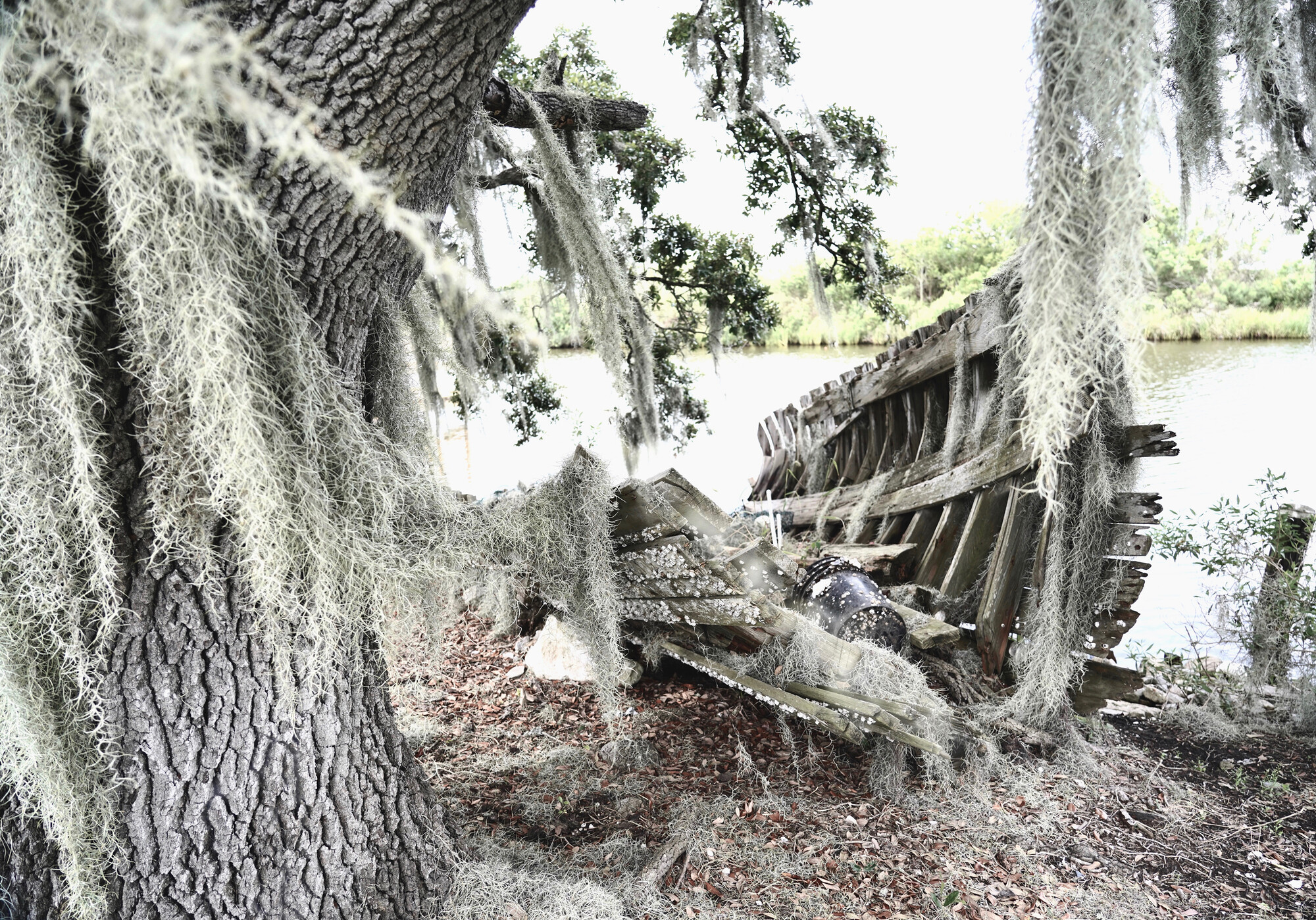
Eighty miles southwest of New Orleans, at the southernmost tip of Terrebonne Parish, the Pointe-au-Chien tribe clings to a vanishing sliver of land called Pointe-aux-Chenes (Oak Point). The green finger of the island points like a warning out to sea. Driving for the first time from New Orleans to Pointe-aux-Chenes, I stop next to a bayou gleaming like green glass under an arcade of towering trees. Snowy egrets and roseate spoonbills lift gracefully over the water; flying beneath them through the water are their perfect, white reflections. The landscape is dreamy and confounding. Where my eye expects land, there is a watery stillness and shimmering reflection so calm it is trancelike. Gauzy Spanish moss overhangs the water, filtering the green sunlight.
The day is stunned by sun. I step inside one of the trees, lifting veils of moss. A kingfisher rattles down the bayou. The tree astonishes. Huge and misshapen, it belongs in a children's story book. I half-expect it to lumber across the bayou, or that a wooden door to another world open in its knobby trunk. I enter the tree and the tree enters me. Inside a green nave, cool air pours over me. The tree's leafy fingers trail in the water. Lavender hyacinth blossoms float on the bayou. Purple irises mantle the banks. A golden orb spider hangs in its lacey web. Specks of brightness swim in sunbeams like slow-moving fish. The tree's great branches reach down, knuckles touching the ground. A dragonfly shimmers. Here is the elixir of life.
Outside an insect drones persistently. I step back into the sun and cross a narrow bridge that arcs over the bayou onto Pointe-aux-Chenes. The insect has become a rasping roar that resolves in minutes into a yellow Camaro that hurtles towards the bridge and me. The car rattles over the narrow bridge and spins to a halt in a shower of gravel. The driver rolls down his window. "You know you are standing on Indian land?" he yells. "You know this will cost you? You have a permit? No permit is a $40,000 fine!" Then his face cracks in a huge grin. "I'm ribbing you!" he yells. "Where you from?" I tell him why I am there. Within minutes, I am sitting next to the bayou on a crab crate with Jake Dardar under a fish shack with his family, Russell and Donald Dardar, all Pointe-au-Chien Indians. Behind us, houses on risers are set in deep shade under a canopy of immense live oaks.
Etymologically the word "ghost" is a verbal trace of gast (guest). Ghosts mark an uncanny or unwelcome intrusion, a trespass. Am I an unwanted intruder here: a guest, or a ghost? Pointe-aux-Chenes is the last village on the edge of nowhere. Except that nowhere, once you are there, is a place so present and immersive, the people so vibrant and embracing, that every other place fades into elsewhere. From the day I meet them, the islanders offer me a welcome that humbles and awes me. Sitting that day in the fish shack, when I ask if I might take photographs, and if so, what they would want me to take, Russell says "Take every photograph you can. The next big hurricane—it all be gone." Russell gets up and returns with a piece of paper. He hands it to me, but a gust of wind snatches it to the ground. Without thinking, I step on the paper before it floats into the bayou. Russell says softly and without rebuke. "You are standing on Indian land." He hands me the paper. It is a photocopy of a map of how his island looked a few decades ago, when it was surrounded by bright green marshland instead of water. The land of "used to be." This gift of paper binds us from here on.
Fugue in Colonial Déjà Vu
It has happened before, but there is nothing to compare it to now.
—Thomas Pynchon, Gravity's RainbowVanishing? Vanishing? We are not going anywhere.
—Chantel Comardelle, Tribal Executive Secretary of the Biloxi-Chitimacha-Choctaw Tribe, Isle de Jean Charles
There should be a special word for trespassing on land of your own belonging. Pointe-aux-Chenes captures in miniature a global future of mass displacement. The Pointe-au-Chien Indians are caught in a brutal paradox, wanting to stay on the land they love, but facing forced removal by rising floods, encroaching saltwater, the ravages of the oil companies, and devastation from the BP Macondo oil disaster.
For thousands of years, Native tribes—the Houma, the Bayougoula, Biloxi, Choctaw, Quinapisa, Acolapissa, Pascagoula, and others—inhabited the Mississippi River delta and coast. They lived with the water, moving with the seasons and the floods, sustained by the wetlands' abundance. The Pointe-au-Chien forbears fled the brutal land theft of the 1830 Removal Act, a colonial cataclysm during which thousands of Native people were driven off their lands east of the Mississippi. The Trail of Tears enacted a double violence, against both Native people and enslaved Africans. Native lands were emptied to make way for colonial sugar and cotton plantations. In Louisiana, slavery created fortunes for plantation barons and was so brutal that many Africans on the sugar plantations died in as little as seven years after arrival. Some Native people fled south to the deep bayous. "Bayou" is Choctaw for "slow moving water," a verbal ghost of a language that is almost lost. There they found refuge in wetlands so abundant they sustained themselves in peaceful solitude for nearly a century.
A hundred years ago, Pointe-aux-Chenes island (like the better-known Isle de Jean Charles across the water) was a verdant, oak-forested land in a sea of soft, spartina grass. Hundreds of people lived peacefully in thatched houses under a canopy of immense live oaks. Gardens lush with creole tomatoes, purple eggplant and watermelon, cucumbers and squash. Fruit trees laden with figs, peaches, and persimmons. Oranges and blackberries for the picking. Red chickens roosted in the trees. In flower-filled meadows fat cattle and horses grazed. Oak trees provided wood for flat-bottomed boats, wooden chests, paddles, needles, drums. Cane breaks offered baskets and carpets of intricate beauty. Owls nested in the high canopy. Scarlet tanagers and indigo buntings, golden orioles and blue jays flashed through the green air. Once vast clouds of pigeons descended to feast on acorns. The oak forest sheltered racoons and coyote, deer and black panthers, wild boar and black bear. Down the bayou, bald eagles and osprey nested in the scarecrow branches of the cypress trees. During spring, the marshes were loud with blue winged teal and snow geese. The forest offered rich repositories of medicinal plants and healing knowledge. People call them "forest pharmacies." Now all of this is gone. Gone too are the necklaces of barrier islands and vast, soft marshes that sheltered them from the storms.
In the 1930's the oil companies came, bringing the invisible flood of white saltwater and ruin. A white-owned oil company called "Apache" now owns the surrounding water. The company lied to the elders, who signed their land away with an "X" on a piece of paper. The symbol X means "displa...


Comments
Post a Comment